Day 5: Truckee CA to Sparks NV

Today’s Highlights:
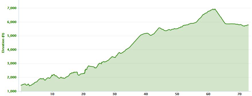
We had an exceptionally scenic ride today over the Sierra Nevada mountains. Leaving Truckee before 7:00, we enjoyed some very crisp 45 degree mountain air. It was quite chilly riding in the shade of the tall pines since I dress lightly anticipating a quick warm up. Our route followed the Truckee River for several miles on the road. Then after reaching the Olympic Village, we got on a bike path that continued to follow right along the river’s edge. It was very tranquil and scenic. The trail ended in Tahoe City where we got our first glimpses of Lake Tahoe. The town was very nice, and the lake views were great. It had warmed up by then, and was sunny and clear. We could see the mountain range all around the lake, some of their peaks snow covered.

Some of us stopped at a bakery in town to get a quick treat of energy before our big climb of the day. Shortly after that we entered Nevada. From there we started climbing Mt Rose, rising almost 3000 feet in eight miles. As we climbed, there were more views of Lake Tahoes, including a spectacular vista at one highway pullout. The surrounding mountains and forest were also beautiful, making the climb even more fun. Just before the summit was a mountain meadow that I stopped to admire for a while. I reached the summit around 11:20 where we had our one rest stop for the day. It was a comfortable 75 degrees there.

Leaving the summit, we had eighteen miles of steep winding downhill. That was really fun. As we dropped down, the scenery change dramatically to a desert landscape. The temperature rose into the 90’s. I reached the hotel before 2pm, happy to get out of the heat.

Pictures Of The Day: Click any thumbnail to see the photos in full screen mode.

Statistics: Zoom and pan the map to explore the route.

Time:
6/6/2013, 6:47:36
Duration:
06:49:38
Ascent/Descent:
3968 ft 5484 ft
Distance:
68.43 M
Posted in 2013 Cross Country Bike Trip, Biking | 2 Comments

Day 4: Auburn to Truckee

truckee_climb

Today’s Highlights:
Today’s ride was epic! We climbed almost 8000 feet in our 72-mile ride from Auburn to Truckee, cresting at Donner Pass around mile 62. The magnificent view from the top made the climb all worthwhile.

We started our day with a 5:00 am luggage load and 5:15 breakfast. I started my ride at 5:45, just as the sun was coming up and rode alone to the first rest stop. The morning was cool and just right for climbing. We traveled country roads that paralleled close to I80 and I saw a little wildlife along the way. At 18 miles we dropped down into a forested canyon and had to climb back out. It was very peaceful in there, and what I noticed the most was that I could no longer here the I80 traffic and finally heard the birds singing. At our first rest stop I met up with Bud and Ken. From there we leapfrogged each other throughout the day, but mostly I rode alone. At 36 miles we entered Interstate 80, and by then the temperature was in the 80’s and climbing. There was a nice shoulder, but a lot of traffic, especially trucks, which roared by as they climbed the unending grade. It was nice to get off there after 16 miles.

Fifty miles into the ride we started climbing Donner Pass Road which was a little steeper than earlier sections. The scenery got better, traveling through tall pines. Ken, Bud and I crested the pass together and stopped for pictures there. The view down to Donner Lake was very beautiful. It was unusually warm today, about 80 or 90 (it can sometime snow this time of year up there), and you could see for miles under the clear blue sky.

The next five miles was a steep winding downhill. I did not make up any time through, since I stopped very often to enjoy the view and take pictures. The ride along the lake was flat and pleasant, and the mountain lake homes along its shore were very nice. Our route also went through the center of the town of Truckee, and I wished there was more time to explore it. I stopped in several places for pictures. Leaving the edge of town, we crossed over the Truckee river and climbed for 1.5 miles to the hotel. Ken, Bud and I reached the hotel around 2pm, about two hours before the next rider arrived. It was a long, hot, strenuous day for everyone.

We are staying in a nice lodge tonight. They greeted us with cold bottles of water and delicious chocolate chip cookies.

Pictures Of The Day: Click any thumbnail to see the photos in full screen mode.

Statistics: Zoom and pan the map to explore the route.

Time:
6/5/2013, 5:43:59
Duration:
08:33:36
Ascent/Descent:
7947 ft 3590 ft
Distance:
73.14 M
Posted in 2013 Cross Country Bike Trip, Biking | 4 Comments

Day 3: Sacramento to Auburn

Today’s Highlights:
I’ve already lost track of what day of the week it is. It’s just “day 3” of the adventure. We had a nice easy ride today. Only 50 miles, mostly flat with a good climb at the end, and beautiful comfortable weather. We left Sacramento at 7:00 and got right on the American River trail. It meandered along the river in the shade of the trees for about 25 miles, then continued above the dam and a little more open for another 10 or so. There were open fields along the way, and I saw turkey, quail, lots of birds and squirrels. One squirrel tried an attempted suicide under my front wheel. I went over it with both wheels, and the biker behind me winged it also. It kept running, and I’m sure it’s pretty sore right now. I was glad it didn’t go through my front spokes, because the outcome (for me) might have been bad.

I rode with Diego for most of the river trail. Along the way, I started chatting with a local rider to make sure we were headed in the right direction, as there were many intersections in the trail. It turned out that her husband was born in Poughkeepsie and worked for IBM there for many years before transferring to San Jose. They had visited Poughkeepsie just a few months ago and visited the Walkway, FDR, Westpoint and other sites. Small world.

We had a rest stop at Beal Point, Lake Folsom. From there, I rode alone to Auburn and enjoyed a nice hill climb. I met up with Mark at the edge of town, and we stopped for lunch there around 11am. We reached the hotel around noon. It’s nice that we have more rest time this afternoon, because tomorrow will be a killer day. The schedule calls for breakfast at 5:00 and on the bike by 6:00 am. Awesome!

Pictures Of The Day: Click any thumbnail to see the photos in full screen mode.

Statistics: Zoom and pan the map to explore the route.

Time:
6/4/2013, 6:54:15
Duration:
05:04:36
Ascent/Descent:
2417 ft 892 ft
Distance:
50.49 M
Posted in 2013 Cross Country Bike Trip, Biking | 4 Comments

Day 2: Vallejo to Sacramento

Today’s Highlights:
Our second 70-mile ride was great. We had a little delay getting started due to the personal attention the lone cook at the little diner paid to each and every person’s breakfast. Some riders waited almost one hour to get served, but it was yummy. We finally got on our bikes at 7:50 am. After a short ride through town, we turned east into the American Canyon. It was a nice steep climb through ranch country. After cresting the hill, our decent was accompanied by a strong tail wind. We coasted down at over 30 mph with no effort. The rest of the ride was flat and we continued to enjoy a tailwind for half the ride, averaging over 17 mph.

The first rest stop was set up at the Jelly Belly factory. Some people took a tour. I didn’t hang around long because I wanted to get to Sacramento early. From there, we traveled through a flat valley dotted with huge farms. California grows a lot of food! After 40 miles, the wind shifted and we had to pay back some of the help we received by pushing against a headwind. Fortunately, the last ten or so was again helped by a tail wind.

We rode several miles on bike paths along side freeways, which was not very scenic, but still a good ride. We also rode through the UC Davis campus.

After crossing the Tower Bridge, we entered Old Sacramento. It is a very interesting place to visit, with old cobblestone street, wooden boardwalk, and period architecture. After a brief visit there, I rode the last mile to the hotel. I spent most of the day riding with Bud, Ken and Mark.

This evening, my sister June visited me. We went back to Old Sac and toured around some more. Checked out the Delta King and a few shops. Evangeline’s (my granddaughter’s name) had a lot of oddities for fun and strange events. June joined the group for route rap and dinner. We eat at the New Blue Sky Chinese restaurant, recommended by Andy (one of the riders), and it was outstanding!

Looking forward to another nice ride tomorrow. It’s getting hot here.

Pictures Of The Day: Click any thumbnail to see the photos in full screen mode.

Statistics: Zoom and pan the map to explore the route.

Time:
6/3/2013, 7:42:40
Duration:
06:07:27
Ascent/Descent:
1048 ft 1107 ft
Distance:
70.21 M
Posted in 2013 Cross Country Bike Trip, Biking | 1 Comment